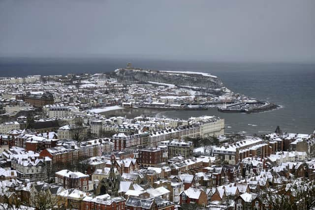
Is it going to snow this weekend? Here’s your Yorkshire coast and North York Moors weather forecast
and live on Freeview channel 276
Today, Friday March 10 sees a yellow weather warning for ice in place until 10am tomorrow, Saturday March 11.
Tomorrow will see a yellow weather warning in place for snow and ice, from 3pm until 6am Sunday March 12.
Advertisement
Hide AdAdvertisement
Hide AdThe Met Office says snow showers are likely to cause some disruption to travel with a small chance of more widespread disruption for some, and will continue to cause disruption through until Wednesday.

There is a small chance of travel delays on roads, along with delayed or cancelled rail travel.
There is a slight chance that some rural communities could become cut off, and a small chance of injuries from slips and falls on icy surfaces.There is also a small chance that power cuts will occur and other services, such as mobile phone coverage, may be affected.Gritting information and salt box refill requests can be found online at the North Yorkshire County Council website.
Here’s this weekend’s weather forecast for the Yorkshire coast, and North York Moors, according to the Met Office:
Advertisement
Hide AdAdvertisement
Hide AdToday: Brighter conditions with isolated snow showers this afternoon, particulary in the North York Moors areas. Many areas will become dry, however, everywhere will feel cold with the northerly wind.
Maximum temperature 5 °C.
Winds are likely to be around 31mph, making it feel like -2°C.
Low tide in Scarborough will be around 11.48am and high tide will be around 5.54pm.
Tonight: Any wintry showers soon dying away then dry and clear. A widespread sharp frost will quickly develop, with ice on untreated surfaces and perhaps isolated freezing fog patches forming.
Minimum temperature -2 °C.
Winds will be around 20mph, making it feel like -5°C.
Advertisement
Hide AdAdvertisement
Hide AdSaturday: Very cold but sunny start, then staying dry while high cloud arrives and any patchy freezing fog clears. Rain moving through overnight, probably preceded by sleet or snow this evening.
Maximum temperature 6 °C.
Winds are likely to be around 9mph, and it will feel like 4°C.
Low tide in Scarborough will be around 12.18am and 12.19pm, and low tide will be around 6.21am and 6.30pm.
Sunday: A dry, cloudy start with bright spells by midday. Windy through the afternoon, and conditions turning into milder with spells of rain arriving later on in the day and through the night.
Maximum temperature 10°C.
Winds are likely to be around 32mph, making it feel like 6°C.
Low tide in Scarborough will be around 12.49am and 12.53pm, and high tide will be around 6.58am and 6.59pm.