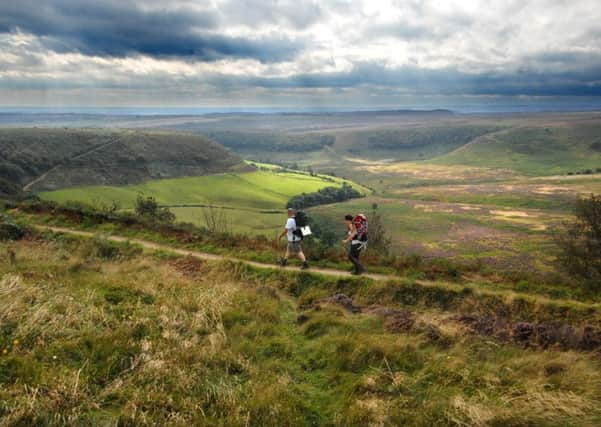
Walks: Scenic panoramic view along moorland


Start from Saltergate car park, about eight miles north of Pickering on the A169 Pickering to Sleights road. Or from Scarborough, head north from Thornton-le-Dale. From the latter, turn right up Whitbygate to the Fox and Rabbit, to continue along the A169 from there.
Walk from the car park northwards along the roadside path beside larch and pine trees.
Advertisement
Hide AdAdvertisement
Hide AdVery shortly turn right along a farm lane as indicated by a bridleway sign. Remain on this lane leading to Newgate Foot Farm. Enter a gate warning, ‘No Through Road’.
This is the Old Wife’s Way, an ancient pack horse track once used to transport salt to the coast, and cured fish from the sea, inland.
The ‘old wife’ may have been a tinker selling trinkets to farmers’ wives wandering the moors.
View Long Gill and a reservoir, taking you back in time to the end of the Ice Age, when melting glaciers carved out a deep valley.
Advertisement
Hide AdAdvertisement
Hide AdAhead rises the mound of Blakey Topping above the forestry.
Sheep may be your sole encounters as you follow the concrete lane towards Newgate Foot Farm, ignoring an offshoot right to the Bridestones etc.
Descending steeply, you’ll observe off left and must seek a diversion sign off left, and up the bank to a handgate before the farm is reached. You’ll use this later on your return from a little detour to Blakey Topping.
[Short detour: Descend to Newgate Foot Farm and go left between stone out-buildings.
Advertisement
Hide AdAdvertisement
Hide AdPass sheds to reach a farmgate, and the National Trust sign to Crosscliff and Blakey Topping. Enter, and take the grassy slope ahead beside left woodland.
A handgate opens onto Blakey Topping, to be explored at leisure.]
Return to the farm, swing right up the lane past an out-building, and from a sign go right up the bank to a handgate, as previously mentioned.
Veer left on a grassy footpath at the foot of the bank. Post and wire fencing is followed, as you descend steps to a handgate.
Advertisement
Hide AdAdvertisement
Hide AdCut across rushes and meadow to a farm gate, just to the right of pine trees. Enter the gate, and cross sheep pasture to the Blakey Rigg forestry boundary. Pass between gate-posts and soon post and wire fencing is to your right.
Your grassy bridleway continues via an open gate, becoming a narrow path up sheep-grazed moorland, with plantations further to your right. Leaving by an arrowed stile, keep straight ahead.
Crossing an expanse of bracken, bilberries and heather, glance back to view Blakey Topping. The path returns you to the forest’s perimeter and another gate opening onto the approach to Malo Cross.
This cross is an ancient way of indicating the salt route to Whitby. From the signpost is a view north to Fylingdales Moor and the Ministry of Defence’s radar equipment at the ‘pyramid’. Another view is towards isolated Nab Farm, best observed alongside Whinny Nab.
Advertisement
Hide AdAdvertisement
Hide AdTurn left as directed to Horcum, between Whinny Nab and post and wire fencing, with a steep drop as you ascend, on your right.
Follow blue bridleway arrows, and beyond the next gate a narrow footpath guides you to the right of an electricity pylon.
Enter a handgate, and follow the left post and wire fencing past conifer woodland to your immediate right.
Leave by a gate opening into the Old Wife’s Way.
Turn right, as this leads to the A169. Now turn left to return to the car park.
Advertisement
Hide AdAdvertisement
Hide AdDistance: 5 miles, to include a glimpse of Blakey Topping too.
Refreshment: Fox and Rabbit Inn, Lockton, or take a picnic.
OS Explorer Map: North York Moors Eastern Area, OL27. Scale 2.5 inches to 1 mile.